Москва, как и любое другое место на земле, откроется совершенно с иной стороны, если для прогулки по ней воспользоваться двухколёсным транспортным средством. Театры, музеи и храмы, некогда разделённые тёмными тоннелями метро, окажутся в двух шагах друг от друга; широкие и длинные проспекты, неподвластные невооружённым ногам, сложатся в единый архитектурный ансамбль. Детали, неразличимые из окна автомобиля, поразят вас своими историями, а посреди никогда не спящего мегаполиса обнаружится нетронутый уголок природы.
Идея езды по Москве на велосипеде может показаться не очень удачной. В этом есть свой смысл: город, хоть и меняясь в лучшую сторону, тем не менее остаётся мало приспособленным для спокойной размеренной езды. И всё же в нашей столице можно спланировать несколько непрерывных маршрутов по паркам, набережным и дорогам с небольшим движением.
Moscow, like any other place on earth, will look completely different if you use a two-wheeled vehicle to stroll around it. Theaters, museums and churches, previously separated by dark subway tunnels, turn out to be two steps away from each other; wide and long avenues that are inaccessible for the unarmed legs will form a uniform architectural ensemble. The details, indistinguishable from the car window, will amaze you with their stories, and in the middle of a never sleeping metropolis you will discover an untouched corner of nature.
The idea of cycling around Moscow may not seem like a good one. This has sense: the city, although constantly changing for the better, nevertheless remains uncomfortable for a calm, peaceful ride. But still you can plan several continuous routes through parks, embankments and roads with little traffic.
Сегодняшний маршрут по большей части проходит по северо-западной четверти Москвы. Традиционно этот округ занимает первое место в различных рейтингах, иногда уступая центральному. Здесь мало промышленных зон, зато много водоёмов (более трети всей городской акватории) и лесов, экологическая обстановка является наиболее благоприятной, воздух большую часть времени пригоден для дыхания. Здешние поселения стояли по пути в Санкт-Петербург, столицу Российской империи, здесь проходили основные рубежи обороны в Отечественных войнах, да и сегодня район играет немаловажную роль в жизни столицы. Маршрут рекомендуется абсолютно всем, кто пресытился достопримечательностями внутри садового кольца и хочет узнать, где гуляют настоящие москвичи.
Today's route mostly passes through the north-western “quarter” of Moscow. This district regularly ranks first in various ratings, sometimes being inferior only to the city center. Only a few industrial areas are located here, but there are many water reservoirs and forests; the ecological situation is favorable; the air is fit for breathing most of the time. Former local settlements were located on the road to St. Petersburg, the capital of the Russian Empire; the main lines of defense in the Patriotic Wars were also held here, and today the region still plays an important role in the life of the capital. This route is recommended absolutely to everyone who is bored with sights inside the Garden Ring and wants to find out where the real Moscow people (Moskvitchi) are spending their spare time.
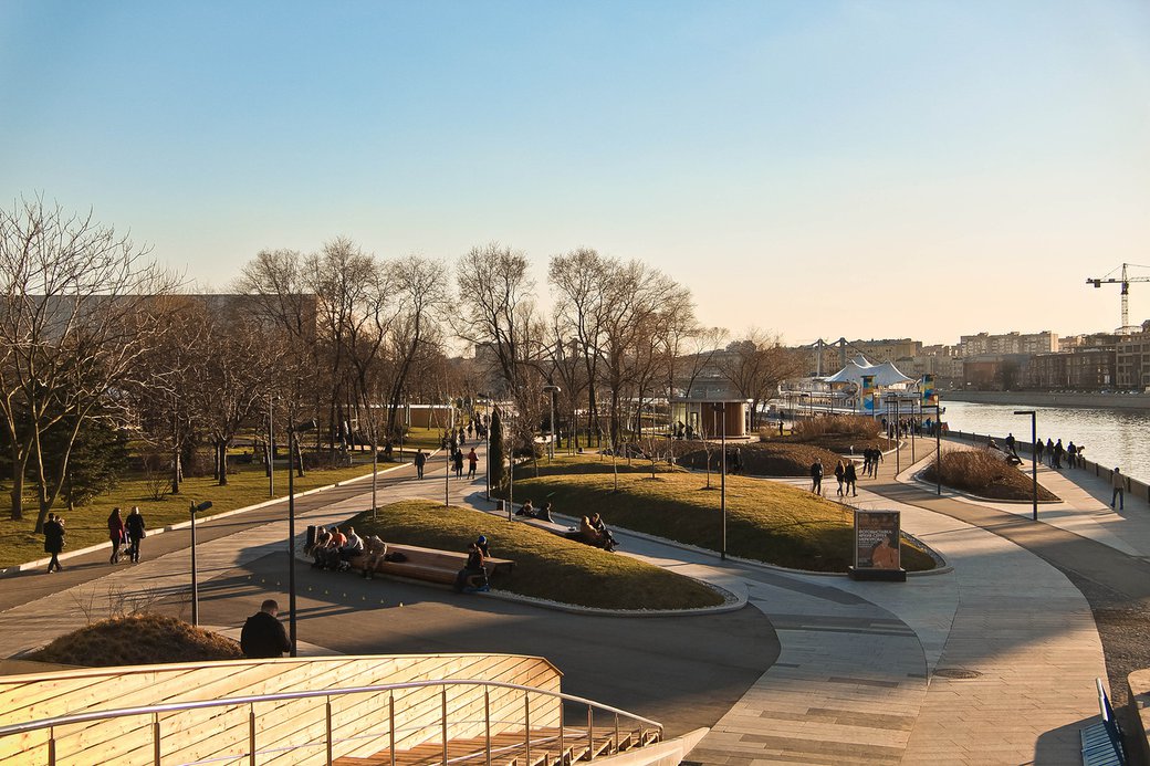
Парк Горького. Начинается путешествие в центре, на Якиманской набережной напротив Храма Христа-Спасителя. Впереди более десяти километров велодорожек с прекрасными видами на противоположном берегу Москвы-реки. Именно отсюда началось превращение заставленной огромными чёрными джипами и затянутой рекламой столицы страны третьего мира в город, где хочется жить. Процесс идёт небыстро, иногда и вовсе поворачиваясь вспять, общественных пространств до сих пор на всех на хватает, так что будьте аккуратны среди толп людей в начале. Постепенно эти толпы будут рассеиваться.
В ходе поездки над вам пройдут несколько мостов. Второй — остеклённый пешеходный — примечателен тем, что его главная арка раньше являлась частью железнодорожного моста в двух километрах выше по течению и была перемещена сюда баржами в 1999 году. На этой арке всё время кто-то сидит, охрана моста уже давно не обращает на это внимание. За следующим мостом возвышается здание президиума РАН с огромными золотыми декоративными конструкциями на крыше. На четвёртый мост мы забираемся, чтобы бок-о-бок с поездами метро перечесь Москву-реку.
Gorky Park. Our journey begins in the city center, on Yakimanskaya embankment, opposite to the Temple of Christ the Savior. We're heading toward more than ten kilometers long bicycle path with a beautiful view on the opposite side of the Moskva River. It was from here that the capital of a third world country, filled with giant black SUVs and tasteless advertising banners, started transforming into a city where you want to live. This process is not going fast, sometimes it even completely reverses; there are not enough public spaces for everyone, so be careful among the crowds of people in the beginning. Gradually, these crowds will dissolve.
During the trip, several bridges will pass over you. The second — glazed pedestrian bridge — is notable for the fact that its main arch used to be part of a railway bridge two kilometers upstream, and was moved here by barges in 1999. Somebody is always sitting on top of this arch; the bridge security has long been not paying attention to it. The next bridge covers the building of the Presidium of the Russian Academy of Sciences with huge gold decorative structures on the roof. We'll climb onto the fourth bridge to cross the Moskva River side-by-side with subway trains.

Лужнецкий метромост — яркая иллюстрация на тему «Москва не сразу строилась». Сооружённый в рекордно короткие сроки, он начал разрушаться в первый же год. Спустя двадцать с небольшим лет оказалось, что больше половины железобетонных конструкций подвергнуты коррозии. Главная причина — поваренная соль, которую добавляли в строительные смеси для ускорения их затвердевания. Движение поездов метро пришлось перенести на временные пролёты, построенные по бокам от основного моста, сам мост начали реконструировать (фактически, выстраивать заново) только ещё через двадцать лет. За время работ опоры временных пролётов попали в природоохранную зону и в ожидании разрешения бюрократических проблем одиноко стояли в воде до самого недавнего времени.
Luzhnetskiy metro bridge is a vivid illustration to “Moscow was not built right away” (a famous quote from popular movie Moscow Does Not Believe in Tears). Being constructed within a record short time frame, it began to collapse in the very first year. Twenty years later, it turned out that more than half of the reinforced concrete structures were corroded. The main reason was kitchen salt, which was added to the construction mixes to accelerate their solidification. The movement of the subway trains had to be moved to temporary spans built on the sides of the main bridge, and the bridge itself was reconstructed (in fact, rebuilt) only after another twenty years. During the time of work, the pillars of temporary spans fell into the nature protection zone and, in anticipation of resolving bureaucratic issues, stood alone in the water until very recent time.
Лужнецкая набережная. Спустившись с моста, продолжаем движение по другой стороне набережной. Из-за леса на Воробьёвых (бывших Ленинских) горах видны только башни МГУ и Дома на Мосфильмовской, киностудия расположена от него через дорогу. Скоро появится и Москва-сити.
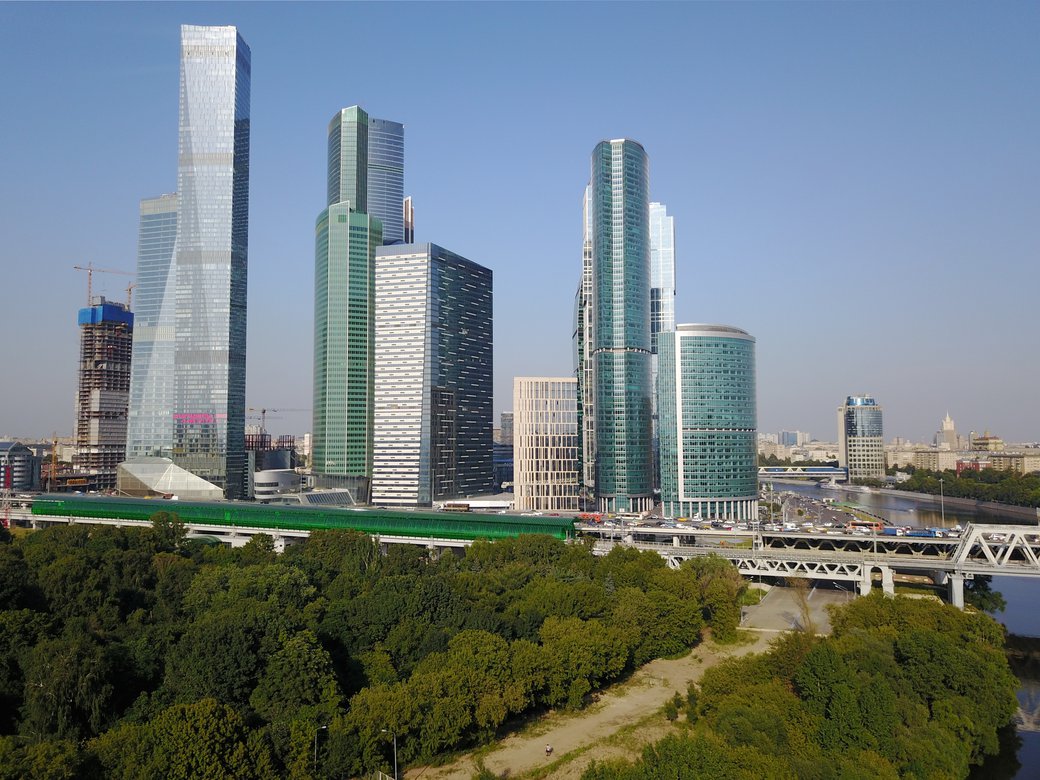
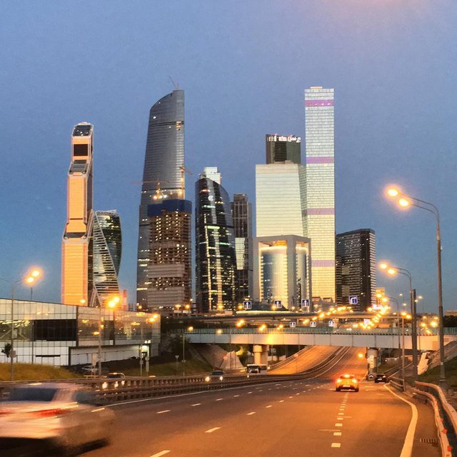
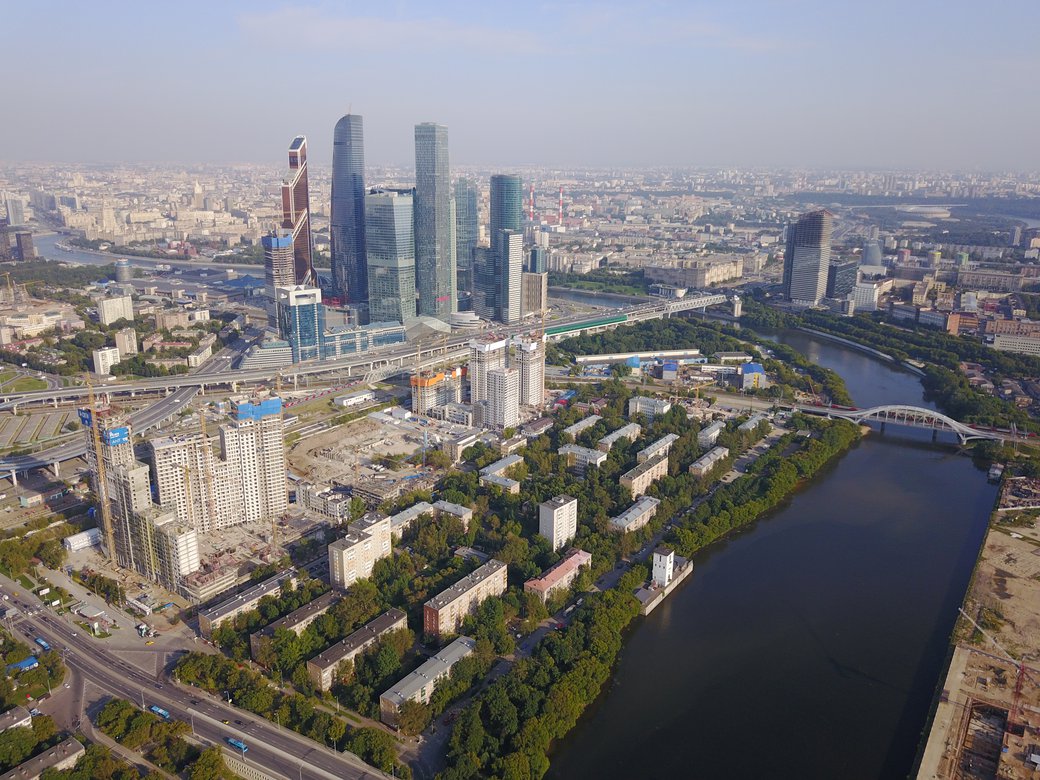
Luzhnetskaya embankment. After descending from the bridge, we continue to move along the other side of the embankment. The forest on the Vorobyovy gory (Sparrow Hills, former Lenin Hills) covers everything except the tower of Moscow State University and the House on Mosfilmovskaya (the Mosfilm movie studio is located across the road from it). Soon the Moscow International Business Centre, also known as “Moscow City” will appear.
Новодевичья и Саввинская набережные. Постепенно возвращаемся в город. Нас встречают трубы ТЭЦ-12. Не удивляйтесь вредному производству в центре города — газовая ГЭС-1 стоит прямо напротив Кремля. По правой стороне уже вовсю мелькают царские дома в Хамовниках, слева неспешно выползают увенчанные башенками дома сталинские (больше такой архитектуры — на ревущем неподалёку Кутузовском проспекте). Стеклянный пешеходный мост, как и то, что мы видели в Парке Горького, был так же перенесён со своего прежнего места вниз по реке примерно на то же расстояние в то же время.
Novodevichya and Savvinskaya embankments. We are returning to the city being met by the pipes of CHPP-12. Do not be surprised with the polluting production in the city centre; remember the gas power plant №1 directly opposite the Kremlin. On the right side, the Tsar's houses in Khamovniki are flashing, the Stalinist houses crowned with turrets are slowly appearing on the left (you can see more architecture like this on the noisy Kutuzovsky Avenue nearby). The glass pedestrian bridge, as well as the one we saw in Gorky Park, was also transferred from its previous place down the river at about the same distance and at about the same time.
Смоленская и Краснопресненская набережные. После Киевского вокзала начинается самое великолепие, сталинский «город будущего», помпезные дома, облицованные гранитом и мрамором, символ возвращения Москве столичного статуса. Пафосное великолепие умело разбавлено типовыми кирпичными девятиэтажками — простым людям тоже надо где-то жить. Мосты сменяются один за другим, башни делового центра то прячутся, то исчезают вновь. Дом правительства соседствует с огороженной колючей проволокой тюрьмой — модным лофтом «Трёхгорная мануфактура». В среднем, примерно это и есть Москва.
Smolenskaya and Krasnopresnenskaya embankments. The grandeur begins after the Kiev railway station. The Stalin's “city of the future”, pompous houses lined with granite and marble, a symbol of Moscow being the capital again. Magnificence is cleverly diluted with standard nine-storey brick buildings — ordinary people also need to live somewhere. Bridges succeed each other, the towers of the business center look out and then disappear again. The House of Government adjoins a barbed wire fenced prison — a fashionable loft "Three-mountains Manufactory". This is what we call Moscow.
Шелепиха. Краснопресненскую набережную сменяет Проектируемый проезд № 758, и тут же заканчивается асфальт. В нескольких сотнях метров от небоскрёбов Московского Международного Делового Центра мы пробираемся по пыльной грунтовой дороге, пахнущей коровником. Аккуратно обходим бандитскую автостоянку по отвесной тропинке между забором и гаражами и попадаем в Шелепиху. Когда-то здесь работал передовой мелькомбинат №4 с полностью автоматизированным элеватором, централизованным управлением всеми машинами и механизмами, выходом к двум железным дорогам и собственным причалом — башней на набережной, соединённой с основными строениями подземным тоннелем. Сейчас всё это сносится и застраивается 50-этажными жилыми домами, в один из которых можно будет расселить оставшийся здесь квартал «хрущёвок». Особым московским шиком считается, отужинав в одном из дорогих ресторанов на верхних этажах делового центра с панорамным видом на Шелепиху, пробраться на железнодорожную платформу Тестовская, и в грохочущем ЭТ2М уехать в своё родное Кунцево.
По тихой набережной поднимаемся на мост и далее проезжаем полтора километра до любого приглянувшегося нам входа в парк Фили.
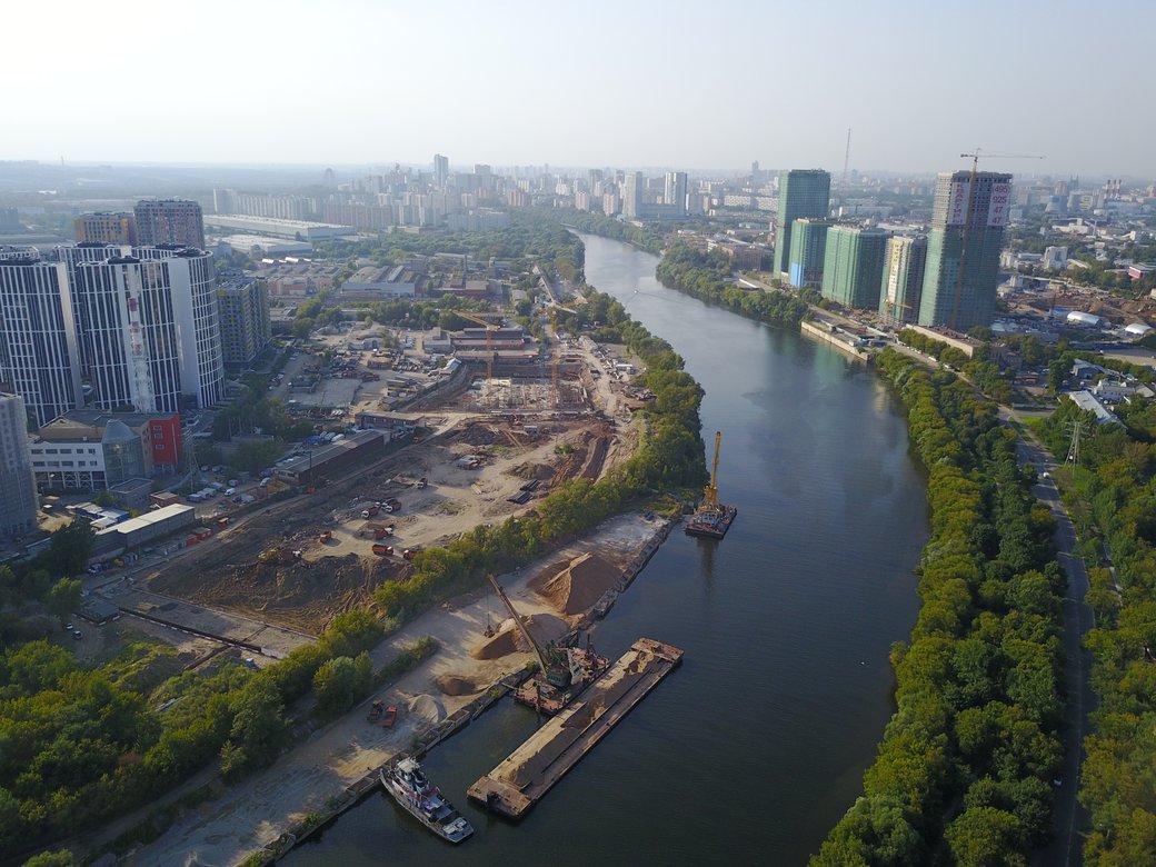

Shelepikha. Krasnopresnenskaya embankment is replaced by Projected Passage № 758 (an actual street name in Moscow, there are dozens of them), and asphalt ends immediately. A few hundred meters from the skyscrapers of the Moscow International Business Center, we make our way along a dusty dirt road that smells like a cowshed. Carefully, we go around the gangster parking lot along the steep path between the fence and the garages and get to Shelepikha. Not so long ago, there was an innovative Mill №4 with a fully automated elevator, centralized management of all machines and mechanisms, access to two railways and its own quay — a tower on the embankment connected to the main buildings by an underground tunnel. Now, all this is demolished and built up by 50-storey residential buildings, one of which will be able to resettle the remaining block of Khrushchev-era houses. A special Moscow chic is having a dinner in one of the expensive restaurants on the upper floors of the business center with a panoramic view of Shelepikha, finding a way to the railway platform Testovskaya, and heading towards your bad neighborhood in an old rattling train.
We go up to the bridge by the quiet embankment and then cycle a mile and a half to any entrance to the Fili Park.
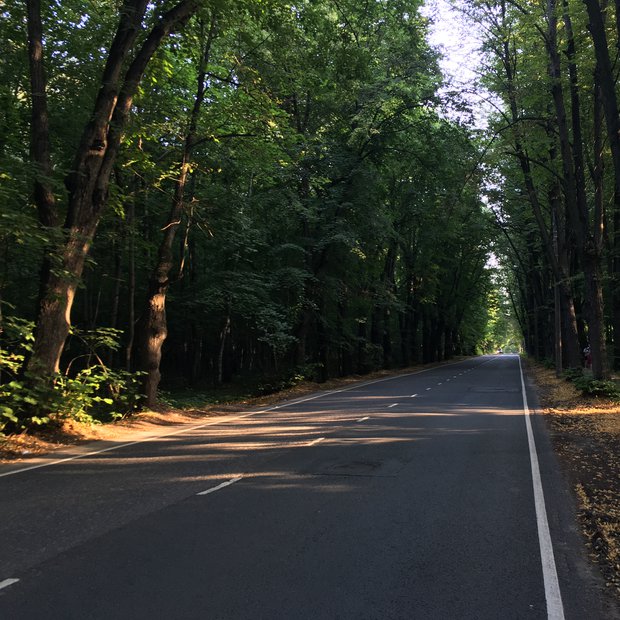
Фили. Парк Фили — один из древнейших парков Москвы, ему уже более двух веков. В любую погоду в густом лесу царят темнота и прохлада. Расположен парк на берегу Москвы-реки, спуск к ней довольно крутой (20%), так что если хочется почувствовать молодецкую удаль, ехать по нему лучше не вниз, а вверх. Сама набережная является красивейшей — нависающие деревья (в дождь, если повезёт с направлением ветра, можно гулять и не мокнуть), манящее закругление по всей протяжённости, относительная удалённость от мест скопления москвичей — многолюдно здесь становится только после недели тридцатиградусной жары, когда парк превращается в пляж. Навигации здесь почти нет, суда обходят девятикилометровую излучину по Карамышевскому спрямлению. Вместо вездесущей плитки здесь уложен ровный бетон, катиться по которому легко и приятно. Это — одно из лучших мест в Москве!
Fili. Fili Park is one of the oldest parks in Moscow; it was created more than two centuries ago. Darkness and coolness reign in the dense forest in any weather. Park is located on the bank of the Moskva River, the descent to it is quite steep (20%), so if you want to feel a brave daring, it's better not to roll down, but to climb down. The embankment itself is the most beautiful — overhanging trees (in the rain, if you are lucky with the direction of the wind, you can walk and not get wet), the alluring roundness along the entire length, relatively large distance from the people — it's crowded here only after a week of heat, when the park turns into a beach. There is almost no navigation here; the ships bypass the 9-kilometer bend by Karamyshevskoe straightening. Instead of the ubiquitous slabs, the bank is paved with flat concrete, which is easy and pleasant to roll. This is one of the best places in Moscow!

Крылатские холмы. Доехав до конца Филёвской набережной, поднимаемся по лестнице к улице Крылатской. Справа будут расположены различные спортивные сооружения — гребной канал, велотрек, ледовый дворец. Слева — ландшафтный парк «Крылатские холмы», по которому проложена обыгрывающая рельеф местности кольцевая велотрасса, сооружённая к Олимпиаде-80. Тяжёлые подъёмы и скоростные спуски, крутые виражи, прекрасное состояние асфальта — здесь в любое время можно встретить множество тренирующихся спортсменов и просто катающихся велолюбителей. Основной тренировочный маршрут — малый круг, несмотря на небольшую длину (немногим более четырёх километров), даже за одно повторение может вымотать не ожидавшего подвоха велосипедиста: набор высоты составляет около 60 метров.
Krylatskiye hills. Having reached the end of Filevskaya embankment, use the stairs to get to Krylatskaya Street. On the right, there will be various sports facilities — a rowing canal, a cycle track, an ice palace. To the left is the landscape park "Krylatskie Hills", along which a circular cycling track, built for the Olympics-80, is laid out. Heavy ups and downhill slopes, steep turns, perfect condition of asphalt — any time here, you can meet a lot of training and simply riding athletes and just amateurs. The main training route is a small circle; despite a short length (a little over four kilometers), even one lap can exhaust the cyclist not expecting a trick: the overall climb is about 60 meters.

Живописный мост и Серебряный бор. Свернув с Крылатской улицы направо, по безымянной аллее доезжаем до лестницы, ведущей на Живописный мост. Автомобили здесь едут со скоростью 100 км/ч внутри шумозащитных экранов, поэтому поездка по предваряющей мост эстакаде может быть не очень приятной, зато, благодаря тому, что мы будем двигаться по огороженному металлическим отбойником тротуару, абсолютно безопасной. Обязательно полюбуйтесь конструкциями моста, подъёмниками, ведущими на смотровую площадку наверху. Когда-нибудь всё это великолепие обязательно заработает.
Перейдя реку, спускаемся по лестнице и направляемся на другой мост — Хорошёвский, ведущий на остров Серебряный бор. Помимо, очевидно, бора, здесь расположились главный городской пляж и элитный дачно-коттеджный посёлок; многие из этих коттеджей хорошо сохранились ещё с царских времён и являют собой прекрасный пример дачной архитектуры того времени, другие же построены в наше время и, вопреки современной русской традиции, сделано это с хорошим вкусом.
Zhivopisniy bridge (Picturesque bridge) and Serebryaniy bor (Silver forest). Turning from Krylatskaya Street to the right, along an unnamed alley, we reach the stairs leading to the Zhivopisniy bridge. Speed limit here is 100 km/h and road is covered with noise protection shields, so a trip through the overpass preceding the bridge may not be very pleasant although completely safe because we will be cycling along the fenced pavement. Be sure to admire the bridge structures, lifts leading to the observation deck at the top. Someday, all this magnificence will surely work.
Crossing the river, we go down the stairs and approach another bridge — Khoroshovsky, leading to the island of Serebryany Bor. In addition to the forest, here is the main city beach and an elite cottage settlement; many of these houses have been well preserved since the tsar times and are a fine example of the country architecture of that time, others are built in our time and, contrary to the modern Russian tradition, are done with good taste.
Троице-Лыково.. Возвращаясь по Крылатской улице, видим шлагбаум автомобильной базы Генерального штаба Министерства обороны и сворачиваем направо на грунтовую лесную дорогу. По ней мы попадаем в одну из сохранившихся на территории Москвы деревень — Троице-Лыково (ещё одна встреченная нами деревня — Терехово — располагалась напротив причала на Филёвской набережной). Из-за леса золотисто горят кресты церквей, за заборами частных домов торчат многоэтажные концлагеря, а под нами пролегает трёхэтажный Северо-Западный тоннель, продолжающий автомобильную трассу Живописного моста и являющегося частью самого длинного перегона в московском метро «Крылатское - Строгино». Нормы безопасности требуют наличия на нём целых двух аварийных выходов: первый был спрятан среди стрёмных одноэтажных зданий на Крылатской улице, а вот второй расположен прямо здесь, в деревне, и при необходимости может быть достроен до полноценной станции. Проехав деревню насквозь, оказываемся на берегу Строгинского залива.
Troitse-Lyuikovo. Returning along Krylatskaya street, we see the barrier of the automobile base of the General Staff of the Ministry of Defense and turn right to the unpaved forest road. Here we find ourselves in one of the villages remaining on the territory of Moscow - Troitse-Lyuikovo (another village we've met — Terekhovo — was located opposite the whatf on Filyovskaya embankment). The crosses of churches burn golden behind the forest, multi-storey concentration camps (this is how Russians call low-quality residential towers) protrude from the fences of private houses, and underneath us lies a three-story North-Western tunnel that continues the highway of the Picturesque Bridge and is part of the longest distance in Moscow metro between Krylatskoye and Strogino stations. Safety standards require the presence of two emergency exits: the first one was hidden among the creepy one-story buildings on Krylatskaya Street, the second one is located right here in the village and, if necessary, can be rebuilt into a fully-operating station. After passing through the village, we find ourselves on the shore of Stroginsky Bay.
Строгино. Слева расположен прекрасный памятник позднебрежневского жилищного строительства — район Строгино. Серийное панельное воплощение утопий пятидесятелетней давности, идеально расчерченных по линейке для идеальных людей, способных оценить строгую ритмику и безупречную симметрию с высоты своего полёта. Уже давно белая кафельная плитка типового советского универмага заменена на аляповатые пластиковые панели «Пятёрочки», а на месте зелёной аллеи между домами воздвигнут типовой православный храм, но всё равно здесь, на Строгинском бульваре, чудесным образом избежавшем превращения в очередную шумную «вылетную магистраль», как ни в каком другом месте чувствуется дух той эпохи.
Strogino. To the left, you can see a beautiful example of the late Brezhnev housing construction — the Strogino district. The standard panel embodiment of utopias of fifty years ago, ideally delineated in the line for ideal people, able to appreciate the strict rhythm and flawless symmetry from the height of their flight. For a long time now, the white tile of a typical Soviet department store has been replaced by the tart plastic panels of “Pyatyorochka” (nation-wide chain of supermarkets for homeless people and alcoholics), and a typical Orthodox church has been erected in place of a green alley between the houses, but still here, on Stroginsky Boulevard, which miraculously avoided turning into another noisy highway, as in no other place you can feel the spirit of that era.
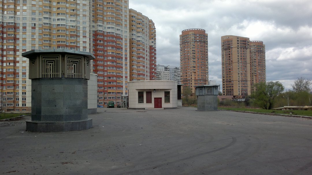
Мякинино. Духом эпохи нынешней можно насладиться, если проехать чуть дальше по этому бульвару и пересечь МКАД, попав в город Красногорск, столицу Московской области. Там, на разных берегах Москвы-реки, расположились дорогие коттеджные посёлки с яхт-клубом и микрорайон «Павшинская пойма», соединённые пешеходным мостом оригинальной конструкции. Несколько сотен метров отделяют дома людей с достатком намного выше среднего от сорокаэтажного гетто с крохотными квартирками и вечным ремонтом у всё новых и новых соседей, настоящими битвами за парковочные места в крохотных тёмных дворах, убогими полиуретановыми детскими площадками и продуваемыми всеми ветрами пустырями вокруг. Если советская утопия родилась из веры в идеального человека, то утопия российская — в человека сверхидеального, телепортирующегося между своим рабочим и спальным местом и, несмотря на открытость границ и глобализацию, по-прежнему не знающим, что можно жить по-другому.
Myakinino. The spirit of the present era can be felt if you cycle a little further along this boulevard and cross the Moscow Ring Road, hitting the city of Krasnogorsk, the capital of the Moscow region. There, on different banks of the Moskva River, there are expensive cottage settlements with a yacht club, and Pavshinskaya Floodplain microdistrict, connected by a pedestrian bridge of original design. A few hundred meters separate the houses of people with a wealth far above the average from the forty-story ghetto with tiny apartments and never-ending construction works noise from constantly arriving new neighbors, rough battles for parking spaces in tiny dark courtyards, squalid polyurethane playgrounds and windswept wastelands around. If the Soviet utopia was born out of faith in the ideal person, then the utopia of Russia believes in a super-human, teleporting between his working and sleeping place and, despite the openness of borders and globalization, still not knowing that one can live in a different way.

Строгинский залив. Промчавшись по набережной, упираемся в самоходную артиллерийскую установку СУ-100 — известное место встречи под названием «у танка». В Строгино располагался один из рубежей противовоздушной обороны Москвы (на Таллинской улице памятным камнем отмечено место, где стояла одна из зенитных батарей) и был сбит первый фашистский самолёт, также здесь начиналась Дорога жизни, снабжавшая блокадный Ленинград, на её месте сейчас одноимённая аллея. Поворачиваем направо — на Строгинский мост. Он проходит по берегу залива, так что, несмотря на относительно небольшую длину, оставляет одни из самых приятных впечатлений от поездки. Дополнительным украшением моста служат фонари-скульптуры и довольно интенсивное трамвайное движение. В хорошую погоду слева виден стадион «Спартак».
Stroginskiy bay. Rushing along the embankment, we run into the tank destroyer SU-100 — a famous meeting place called “near the tank”. Here in Strogino one of the lines of the air defense of Moscow was located (in Tallinn Street a commemorative stone marks the place where one of the anti-aircraft batteries was standing) and the first fascist aircraft was shot down, also here the Road of Life began to supply sieged Leningrad, in its place now there is the alley of the same name. Turn right — to Stroginsky bridge. It passes along the shore of the bay, so that, despite its relatively small length, leaves one of the most pleasant impressions of the trip. An additional decoration of the bridge is a lantern-sculpture and a rather intensive tramway traffic. If the weather is good, you'll be able to see the Spartak stadium on the left.
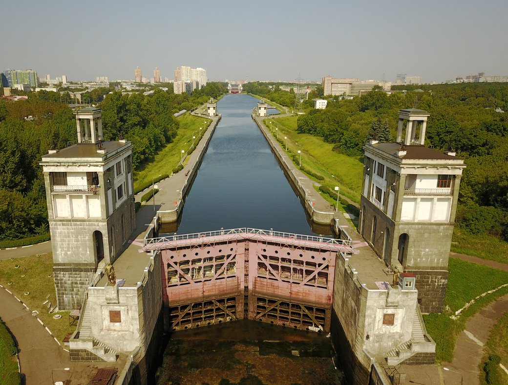
Канал имени Москвы. Через дворы высотного ЖК «Алые Паруса» попадаем на набережную канала имени Москвы — величественного сооружения, к которому мы ещё не раз вернёмся в следующих наших поездках. Роль этого канала в жизни города трудно переоценить — уже в начале XX века Москва-река настолько обмелела, что её можно было перейти вброд прямо напротив Кремля, а построенная на Истре Рублёвская водокачка перестала справляться с потребностью москвичей в чистой воде в 30х. В итоге Москва снабжается водой из Волги, причём канал длиной 128 км. течёт не сам — на общую высоту 40 метров вода поднимается электрическими насосами. Каждый шлюз канала имеет особый облик в духе сталинского ампира, гранитные башни украшены разнообразными скульптурами, в едином стиле с шлюзами выполнены так же Северный речной вокзал и дом по адресу Большая Набережная улица, 11. У нижней камеры шлюза № 7 чуть севернее этого дома расположен пешеходный мост и смотровая площадка.
Moscow Channel. Through the courtyards of the “Scarlet Sails” high residential building we get to the embankment of the Moscow Canal — a majestic facility, to which we will repeatedly return on our next trips. The role of this channel in the life of the city cannot be overestimated: as early as the beginning of the 20th century, the Moscow River was so shallow that it could be waded right across the Kremlin, and the Rublevskaya water-pump built in the Istra River stopped coping with the Moscow's need for clean water in the 1930s. As a result, Moscow is supplied with water from the Volga River, and the channel, which is 128 km long. does not flow by itself — at a total height of 40 meters, the water is raised by electric pumps. Each floodgate of the canal has a special look in the spirit of Stalin's Empire style, granite towers are decorated with various sculptures, the Northern River Station and the house at Bolshaya Naberezhnaya Street 11 were also built in the same manner. There is a pedestrian a bridge and an observation deck at the lower chamber of floodgate №7 just north of this house.
Железное кольцо. С набережной сворачиваем в парк Покровское-Стрешнево. Для любителей приключений здесь есть полуразрушенная, огороженая собаками и охраняющаяся ЧОПом усадьба, но вообще нас интересует станция МЦК Балтийская, расположенная у северо-восточного выхода из парка. Часть дальнейшего пути предлагается проехать на поезде, поскольку ничего кроме зажатых промзоной и железной дорогой узких пристанционных проездов, разрезанных длинными светофорами и неудобными развязками с автомобильными и железнодорожными магистралями там нет. Садимся в сторону станции «Коптево»: незадолго до неё слева по ходу движения начнётся локомотивное депо «Лихоборы», где, если повезёт, можно будет полюбоваться различными моделями тепловозов, а сразу после станции «Лихоборы» — четверной путепровод через железнодорожную линию в Санкт-Петербург. Выходим на станции «Владыкино» в сторону ботанического сада.
Iron ring. From the quay we turn off into the Pokrovskoye-Streshnevo park. For lovers of adventure, there is a half-ruined, fenced-off mansion, guarded by the dogs, but we are interested in MCC station “Baltiyskaya”, located at the northeast exit from the park. Part of the further way is proposed to be traveled by train, since there is nothing interesting there except narrow station driveways squeezed by the industrial zone and the railway, cut by long traffic lights and inconvenient interchanges with highways and railroads. We board in the direction of the “Koptevo” station: shortly before it, along the way, the locomotive depot “Likhobory” will be seen, where, if lucky, you'll get to admire the various models of diesel locomotives, and right after the Likhobory station — a four-way overpass through the railway line to St. Petersburg. We leave at the station “Vladykino” towards the botanical garden.
Ботанический сад и ВДНХ. Нас встречает главный ботанический сад Российской Академии Наук (не путать с ботаническим садом Биологического факультета МГУ возле МГУ и «аптекарским огородом» на проспекте Мира, также принадлежащим МГУ). Обернувшись вокруг пруда перед лабораторным корпусом, мчимся по главной аллее к чёрному ходу ВДНХ.
Редкий турист доходит сюда, обычно разворачиваясь где-нибудь возле ракеты, а между тем именно здесь начинается всё самое интересное: вычурный павильон «Табак», заброшенный некогда великолепный ресторан «Золотой колос», брутальное «Рыболовство», милые домики и мастерские на кольцевой дороге. Скорее всего, архитекторы-утописты проектировали эту выставку в расчёте на то, что у каждого советского человека будет свой велосипед, ведь именно на велосипеде размеры окружающего пространства сжимаются до комфортных для приятной прогулки!
Botanical garden and VDNKh (VDNKh stands for Exhibition of Achievements of National Economy). We are greeted by the main botanical garden of the Russian Academy of Sciences (not to be confused with the botanical garden of the Biological Faculty of the Moscow State University near Moscow State University and the “apothecary garden” on Mira Avenue, as well belonging to the Moscow State University). Turning around the pond in front of the laboratory building, we rush along the main avenue to the back entrance of VDNKh.
A rare tourist gets here, usually they turn around somewhere near the rocket, losing all the most interesting things: the elaborate pavilion “Tobacco”, the abandoned magnificent restaurant “Golden Spike”, the brutal “Fishing”, lovely houses and workshops on the ring road. Most likely, utopian architects designed this exhibition in the sense that every Soviet citizen will have his own bicycle, because it is on a bicycle that the dimensions of the surrounding space collapse to comfortable ones for a pleasant tour!
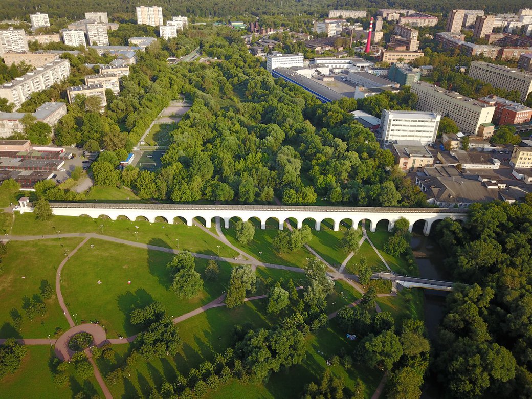
Ростокино и Сокольники. Покидаем ВДНХ возле «рабочего и колхозницы», переходим проспект Мира, проезжаем 500 метров в область и справа от себя видим Ростокинский акведук — самый старый мост Москвы, построенный во времена Екатерины II, и до самого Сталина с его уже знакомым нам каналом имени Москвы снабжавшего москвичей чистой водой из ключевых источников в Мытищах. Перекинут он через реку Яузу, по набережной которой мы и едем, углубляясь в огромный лесной массив национального парка «Лосиный остров», глядя на который со смотровой площадки Останкинской телебашни провинциалы понимают, что бетонные джунгли — это у них в Новосибирске, а здесь лес занимает восьмую часть города.
Вернувшись к цивилизации, поворачиваем направо и оказываемся в, пожалуй, главном природном парке столицы — Сокольниках. У его главного входа и заканчивается наш маршрут. «Природного» пути обратно в центр отсюда нет, но автомобильные дороги будут вполне по силам даже начинающим велосипедистам — все перекрёстки по пути оборудованы светофорами, и проявлять чудеса ловкости езды в четвёртом ряду вам не придётся.
Rostokino and Sokolniki. We leave VDNKh near the sculpture of the worker and the kolkhoz woman, pass the Mira Avenue, cycle 500 meters to the north and to the right of ourselves, we see Rostokinsky aqueduct — the oldest bridge in Moscow, built in the time of Catherine II, and up to Stalin himself, with his already familiar Moscow channel, supplied Moscow with clean water from fountainheads in Mytishchi. It is thrown across the Yauza river, along the embankment of which we are going, diving deep into the huge forest of the “Losiny Ostrov” (Elk's Island) national park, looking at which from the viewing platform of the Ostankino TV tower, the provincials understand that the concrete jungle is in their Novosibirsk, and here the forest occupies the eighth part of the city.
Returning to civilization, we turn right and turn out to be in, perhaps, the main natural park of Moscow — Sokolniki. Our route ends at its main entrance. There is no quiet way back to the city center from here, but the roads will be safe even for beginner cyclists as all crossroads along the way are equipped with traffic lights and you won't need to show mad skills of cycling in the fourth lane.
Комментарии
This is awesome! Fantastic piece of work.
Захотел приехать не на двое суток